PORTFOLIO

Minimal invasive methods to recognize, identify and map deep-sea megafauna using photographs and video imagery transects

The use of photographs and video imagery is a recently developing minimal invasive method to recognize deep-sea megafauna on abyssal plains for ecological studies. This method conducts designated transects on the seafloor with nadir orientated cameras to obtain continuous high-resolution imagery data.

The control center of the "ROV KIEL 6000" from Geomar during a dive

In order to analyze these enormous amounts of collected data, post processing in specific photograph-, and video imagery cutting software, as well as photomosaic and annotation software is obligatory. Furthermore, photogrammetry software to reconstruct 3D surfaces of the seafloor and its megafauna can be applied to visualize faunal occurrences and to use these high-resolution 3D models for ecological analysis and to analyze spatial distribution patterns statistically. Continuous, georeferenced 3D reconstructions or photo mosaics can be created on the basis of the imagery, and their orientation, direction and distance. The 3D software allows a continuous, high resolution analysis of photograph and video imagery and a conversion of this data in GIS applicable maps.

3D reconstruction of the seafloor including high resolution bathymetry and textured models for ecological analysis

An advantage of this method is the little footprint of the data collection, which has, apart from artificially introduced lightning, no direct impact on the fragile deep-sea ecosystem. This is an advantage for e.g. monitoring studies that can be conducted in small-scale habitats, such as hydrothermal vent fields, without disturbing or permanently impacting and altering the fauna present.


Molecular Methods

DNA barcoding | Next Generation Sequencing

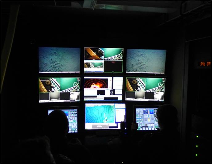
Describing species is a fundamental step to assess the true biodiversity and correct species delimitations have a huge impact for all following studies that are based on this initial identification process. Sampling taking in order to delimitate species can be a demanding task depending on the remoteness of the sampled site and the rarity of a species, which makes molecular identifications a valuable complementary method for traditional morphological taxonomy.

The INDEX “Tree of life” integrating all taxa from the Indian Ocean Exploratiion area

Identifying marine organisms, in particular invertebrates, can be time consuming and costly when relying solely on morphological taxonomy. The delimitation of species can be achieved with DNA-barcoding, but this method offers the possibility to analyze development stages, sexual dimorphism or phenotypic plasticity or cryptic species.

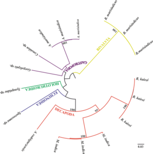
One of the most common genes used for sequencing and delimitation of species is the mitochondrial cytochrome C oxidase subunit I (COI) with a length of 658 base pairs (bp) and a unique sequence for each species.

In order to assign specimens to their genotypic cluster, the COI sequences are collected and stored in a reference library to enhance future identifications.

DNA metabarcoding and eDNA methods are Next Generation Sequencing (NGS) molecular methods, that can be used to improve extractions and amplification (PCR) to identify taxa as operational taxonomic units (OTUs). In addition, microbiomes e.g. between sponges and crustaceans can be genetically analyzed or the connectivity of populations using restriction associate DNA-marker.

Thereby, molecular genetic methods are an essential part of the discrimination of the often widely distributed marine organisms and lately these methods are applied for monitoring studies and the evaluation of biodiversity or for conservation purposes of the marine environment.

Sampling and Analysis of Marine Benthic Organisms

Meio-, Macro-, and Megafauna

Sampling and analyzing benthic deep-sea organisms are a central part of our work. Beside megafauna (individuals bigger than 2 cm), meio-, and macrofauna display a high diversity and high abundances, in particular in sediment dominated habitats. These small specimens play a fundamental role in the food web of deep-sea communities and are good indicators for an early recognition of environmental changes. Specific sampling with tools like box corer, multi corer, epibenthos sledge, dredge or TV-grab can be conducted by our team, including target orientated fixation, post-processing and analysis of the collected samples.

Sample processing on board, including initial identification, photographing and fixation of sampled material.

Taxonomy and Biodiversity

Taxonomy, the hierarchical classification of species is the foundation of all biological deep-sea studies. It is an essential method to acquire the biodiversity in a single or several habitats and incorporates the description and classification of individuals based on morphological characters, often combined with molecular methods.

Biodiversity studies gather data of benthic and pelagic species, especially indices such as species richness, abundances or evenness that help to understand distribution patterns and community structures of the studied organisms.

Statistical Learning

Statistical models are simplified, mathematical approximations to reflect reality and can be used for predictive modelling. The basis of such models are biological samples, in particular the species composition and abundances, reflecting communities, which occurrences depend on biological interactions and abiotic factors that determine the spatial distribution.

These statistical models allow us to make inferences about habitats and communities and the relations and interactions of these communities to each other, based on random samples. This includes predictive modelling techniques, that have an increasing importance for target-oriented sampling, the designation of protected areas or to select preference areas for monitoring studies.

Starting from linear regressions to decision-tree based modelling such as random forest, all available factors potentially responsible for the observed distribution patterns of species or communities can be used to find significant correlations and therefore being able to predict the spatial extent of these species or communities.

Statistical modelling and habitat predicition models are powerful tools,
recommended and needed for the implementation of management plans and decision making processes
in order to identify and protect vulnerable marine ecosystems (VMEs).